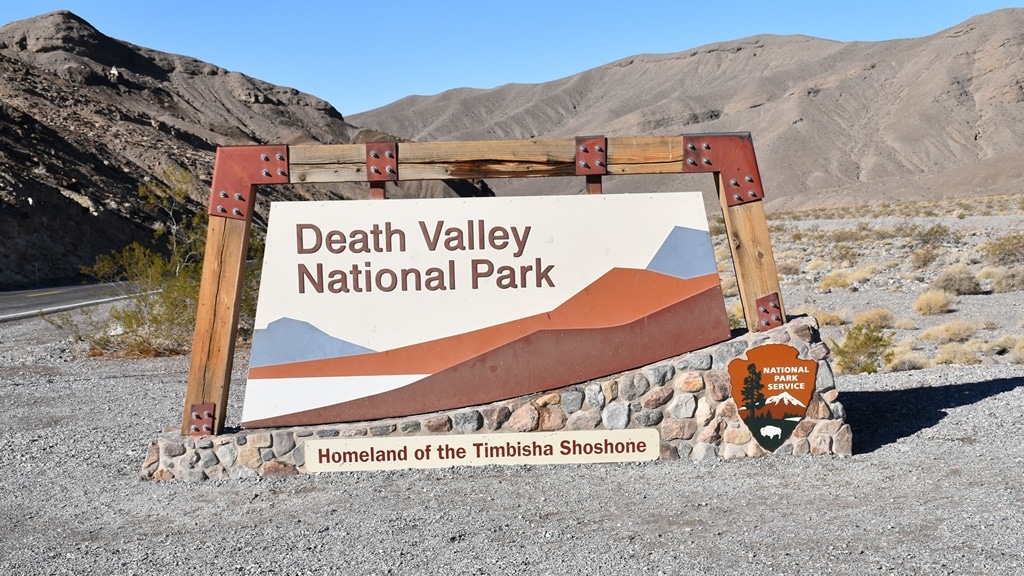
For me, one of the best day trips out of Las Vegas is to Death Valley National Park. Death Valley National Park is a great way to explore some of the most beautiful and unique landscapes in the United States. The park is about a three-hour drive from Las Vegas. As a day trip, it can be done as a loop in about ten hours with plenty of stops for photos and exploring.
It’s Called Death Valley for a Reason!
Let’s get this out of the way: Death Valley is a vast and remote park with some of the most extreme weather conditions in the country. No matter the time of the year, visitors should be prepared for extreme heat, dry conditions, cold, wind, and even dust storms.
For the average tourist, Death Valley is a great place to visit for a day or two. However, the summer months, June thru September are the worst with most days and nights well over 100 degrees Fahrenheit (37 degrees Celsius). Check the current weather in Death Valley.
If you are not acclimated to the dry extreme heat or have an unreliable vehicle, I would suggest visiting a place almost as beautiful and majestic, just not as hot. A place like Bryce Canyon National Park.
If you want to read about how Death Valley got its name and about the “Death Valley 49’ers” I suggest reading “Death Valley in ’49 important chapter of California pioneer history. The autobiography of a pioneer, detailing his life from a humble home in the Green … children who gave “Death Valley” its name” by William Manley. The man who survived it.
I’m saying all this not to scare you. Actually, it’s just the opposite. Death Valley can be an amazing, unforgettable, and wonderful experience if you visit the park as a well-informed tourist who knows where they are going and what they are doing.
What to Bring:
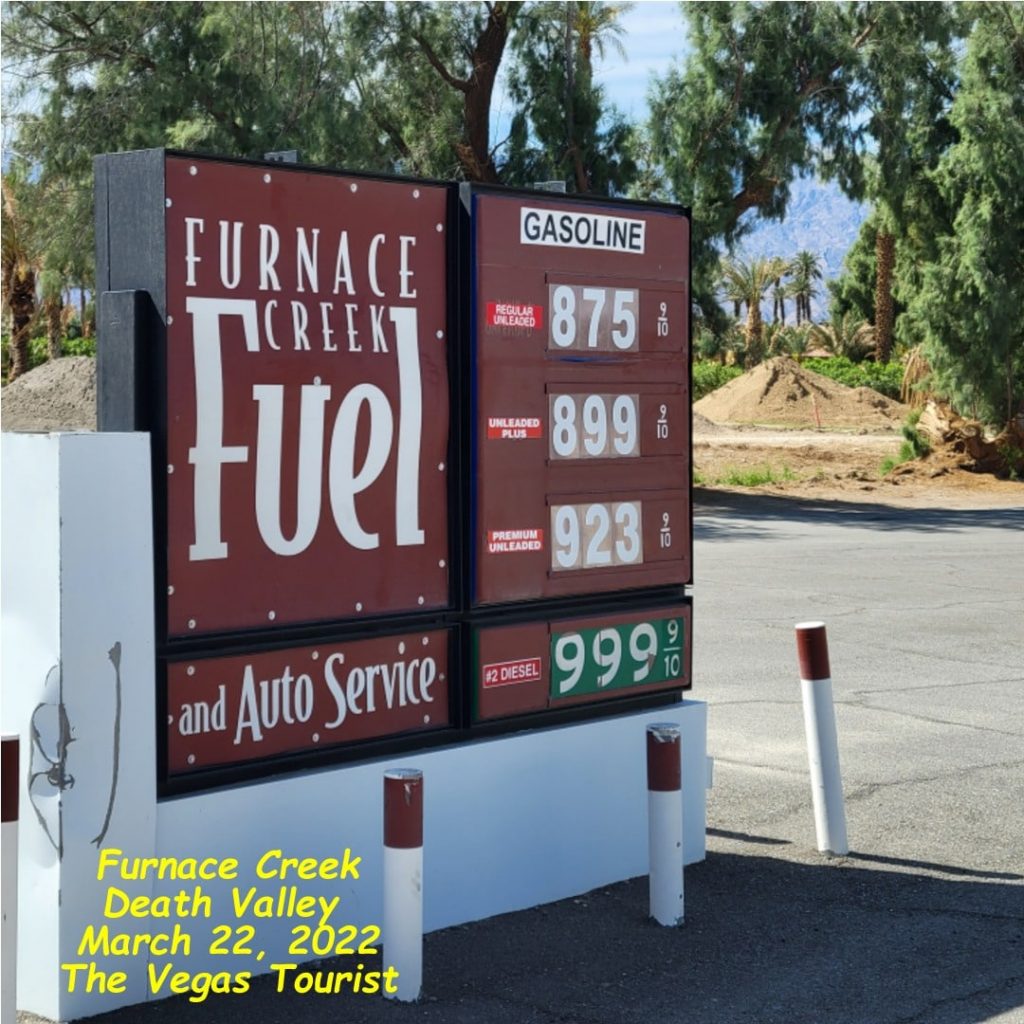
Full tank of fuel. Never enter Death Valley without a proper supply of fuel. There is only one place in Death Valley to fuel up and it’s not cheap!
Plenty of water. Bring more water than you expect to drink. Stay hydrated as well as keep people around you hydrated. I always carry water to give to others who did not plan as well!
Sun protection. Death Valley can get very sunny, be prepared with plenty of sunscreen, hats (preferred wide-brimmed hats), and sunglasses.
Plenty of snacks. High protein snacks are suggested to keep you energized.
Camera/Video. You will want your best recording devices. Keep them charged and ready for action. The entire trip has many photo opportunities.
Cooling Towels. These are best for the summer months. Wet, cool, and wrapped around your neck. Shop Amazon
Alternative clothing. Weather in Death Valley can change. Dress appropriately for evolving weather conditions, Long sleeve shirts, closed-toe shoes, and long pants for hiking.
Sense of Adventure: This is a unique place. It’s not what you think it is and it’s more. The little ten-hour loop I present here will whet your appetite for more and there is much more of Death Valley you can explore another time.
Let’s Go For a Daytrip!
From Las Vegas, start by driving north on Interstate 15 taking US Highway 95 N towards Reno. If you want to set your GPS, tell it to direct you to the town of Beatty, NV.
Outside the city limit, you will see the exits to Mt Charleston, Las Vegas Paiute Golf Resort, and Cold Creek, home to High Desert State Prison (OJ Simpson spent some time there).
As you leave civilization behind, keep an eye out for wildlife and wildflowers along the way. Wild burros are frequent sightings. Further, into the mountains, you may see some bighorn sheep well as other animals. With the changing elevations, you may see plenty of colorful flowers, cactus, and Joshua trees. (Ecology of Death Valley)
You will soon pass an area known as Lathrop Springs/Jackass Flats and the Area 51 Alien Center. A tourist stop for fuel, restroom, alien, and Area 51 trinkets. As well as the Alien Cathouse (Brothel). Yes, there is a real brothel there. No, they do not give free tours and NO free samples!
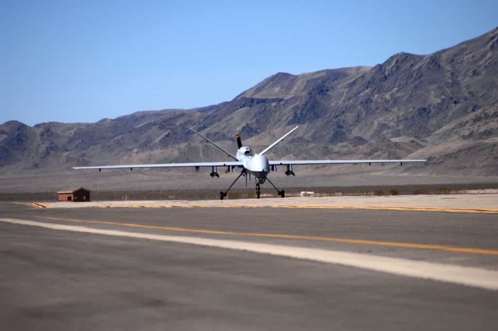
Keep going north, you will head into Indian Springs, home to Creech Air Force Base. Keep an eye out for drones. buzzing around. This is the largest base for the US Air Force drone operations. You may stop at the convenience store across the street to watch, but do NOT pull off on the side of the road. And watch your speed as you drive thru town!
Next to that is the town of Mercury, Nevada. It’s not really a town. This is where the government conducted atomic testing in the 1950s into the 1990s. At first, they were above-ground atomic tests. Later they moved them underground. Ending them entirely in the late 1990s
The final town on this part of the tour is the little hamlet of Beatty, Nevada. At this point, you will be in the middle of nowhere. I mean it, literally… There are no other towns for miles and miles.
Just before you reach Beatty, on the other side of the mountains on your right is Yucca Mountain. This is where the federal government wants to bury all our wonderful nuclear waste.
Beatty is where I would top off my tank, recharge the batteries, in other words, fuel up. My favorite spot is Eddies World. Turn right at the stop sign and Eddies World/Chevron is a little way down the road on your left. Candy from your childhood. Cold drinks, snacks, and fuel. This would be a good time to check your vehicle’s fluid levels. Check your radiator, oil, and your tires.
If you go a little past Eddies World, you may see some wild burros wandering the open fields. But don’t wander too far, we need to get back on tour!
On To Rhyolite
Coming out of Beatty on State Highway 374, you will start to see signs of old railroad beds and trails leading to our first stop: Rhyolite. This is a ghost town that was home to one of the largest gold strikes in Death Valley history. It was discovered by prospector Shorty Harris and his friend E.L. Cross.
The town lasted less than ten years and at its peak, there was a stock exchange, three railroads as well as a red light district that drew women from as far away as San Francisco. There were hotels, stores, a school for 250 children, an ice plant, two electric plants, foundries, machine shops, and even a miner’s union hospital.
The financial panic of 1907 took its toll on Rhyolite and was seen as the beginning of the end for the town. In the next few years, mines started closing and banks failed. Newspapers went out of business. The population went from 10,000 to only 611 residents. In 1916 the light and power were finally turned off in the town.
As you exit the town, on the right is the Goldwell Open Air Museum. The statue of the miner and the penguin is dedicated to Shorty Harris, the prospector who helped discover the original gold mine.
Please Note: The ghost town of Rhyolite is on a mixture of federal and private land. It is not within the boundary of Death Valley National Park.
Exiting there and continuing towards Death Valley National Park, you cross into the State of California. You will come to Hell’s Gate. This is where you can pay your entrance fee to the park. Be sure to go across the road for a dramatic view of the salt fields below.
Salt Creek
Stay to the right of the split, that’s Daylight Pass Road and it ends at California Highway 190, turn left. Watch for the turnoff to Salt Creek. Turn right, and visit. There is a boardwalk there that follows Salt creek. There may be water running (do not drink it) as well as this is where you will see the endangered pupfish.
Continue down the 190 to Harmony Borax Works. Here are the remains of a borax processing plant as well as one of the only remaining wagons that were used to haul Borax out of Death Valley. The wagons were originally painted blue and were part of the famous “Twenty Mule Team Borax”. There are information plaques as you walk around the remains.
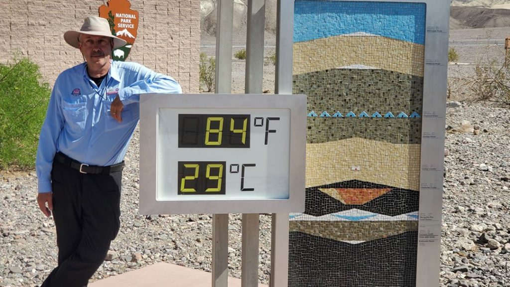
Furnace Creek Visitor Center
Just past the Harmony Borax Works is Furnace Creek Visitor Center. Yes, this is home to the famous Death Valley thermometer. There is also a museum, book store, and real bathrooms!
At the Visitor Center, you can get guidebooks and purchase your America the Beautiful – The National Parks and Federal Recreational Lands Pass here as well. If you did not pay at the Hell’s Gate location, pay here and get your window decal.
Why You Bought Fuel in Beatty
Remember when I reminded you to buy fuel in Beatty? Why do I tell people never to go into Death Valley without a full tank of fuel?
I say that because there is only ONE fuel station in Death Valley and they are not cheap!
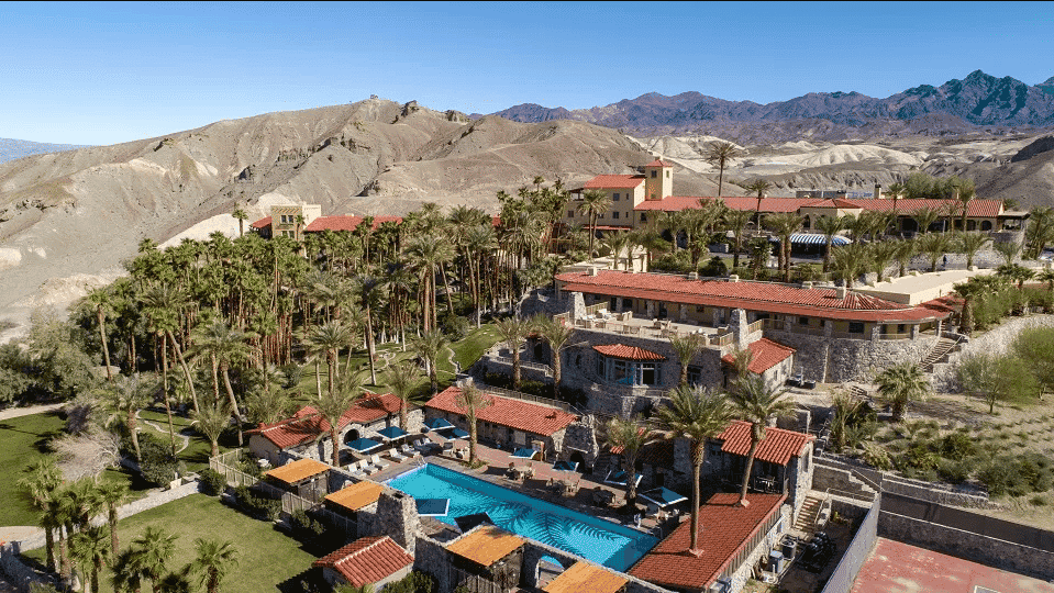
The Ranch at Death Valley
The next stop is literally next door. The historic Ranch at Death Valley. Xanterra, the resort owner, recently did a multi-million dollar renovation and upgrade to the place. With new shops, new amenities, and some new rooms and suites.
However, they did keep a few of its best features: A post office that will give your postcards and letters the official Death Valley postmark. The golf course and several of the original “Dingbat” homes from Boulder City. They moved the houses down here after Hoover Dam was completed in 1935.
Onward to Badwater and More
From the Ranch, continue down to Badwater Road. Follow the signs and follow the speed limit. Go past the Devils Golf Course until you see the signs for Badwater Basin.
Badwater Basin is the lowest point in North America at 282 ft (86 m) below sea level. The salt flats here cover nearly 200 square miles (518 square km), and are composed mostly of sodium chloride (table salt), along with calcite, gypsum, and borax. This is the lowest spot in the Western Hemisphere. 282 feet below sea level.
Look across from the parking lot and up on the side of the mountain, you will see the sign for “Sea level”
After visiting there, coming back the way we came in, you will see the sign on the right for the Artists Drive Scenic Loop. Take it. This road does have a vehicle size limit of 25 feet in length. Do not enter if your vehicle is longer. So no long campers or motorhomes.
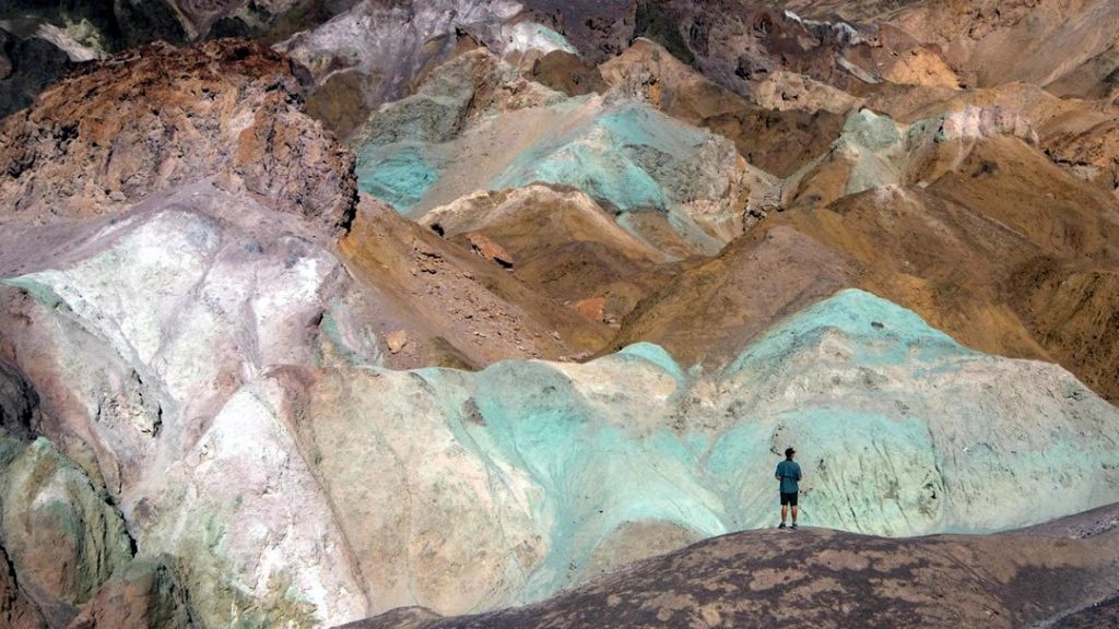
Several nice places to stop along here. The best is Artists Pallete. Here, visitors marvel at an array of colors (red, orange, yellow, blue, pink, and green), splashed across the hills. These colors are from volcanic deposits rich in compounds such as iron oxides and chlorite, which creates a rainbow effect.
At Artists Palette, as well as the path to the right as you exit the loop, was used for some of the scenes in the original Star Wars movie.
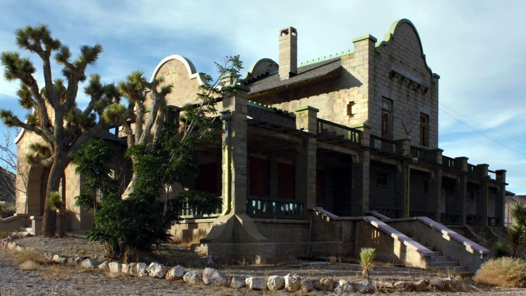
The Inn at Death Valley and Beyond
As you continue back the way you came, you exit Badwater Road and turn right on Hwy 190. In front of you stands the historic Inn at Death Valley. If you stop here, please be respectful of the structures, the people, and the place. It is a working luxurious Inn.
Continuing out the 190, we are heading to Zabriski Point. This is one of the most dramatic and most photographed overlooks in Death Valley.
The spectacular views from Zabriskie Point are some of the most photographed in Death Valley National Park. Zabriskie Point affords an elevated vista from which to marvel at the badlands below. These yellow and brown striped hills have been shaped by the powerful force of water, and even during dry times, the path carved by this water is unmistakable.
Gazing beyond the badlands, views of the salt flats covering the floor of Death Valley are visible in the distance, with the hulk of the Panamint Mountains towering above.
From the parking lot, the actual scenic point is a ¼ mile (400 m) walk up a hill on a paved trail. Those interested in hiking in the badlands can pick up the Badlands Loop Trail at the Zabriskie Point parking lot.
Zabriski Point is our last stop inside Death Valley National Park. From here, we head towards Pahrump Nevada and civilization. With maybe one more stop!
Out We Go
This was meant to be a very easy, scenic, and fun loop from Las Vegas, through Death Valley, and back to Las Vegas. As you can tell, there is so much more here to explore. In order to keep to our ten-hour time frame, we need to continue down the highway and back to Las Vegas.
Highway 190 will T-off at Death Valley Junction and the Amargosa Opera House. Take a right, then a left. In the corner opposite the hotel, is a small structure that gives you some insight into Marta Beckett and her story of Death Valley Junction. Not to mention the famous Amargosa Opera House.
Back to Civilization
From Death Valley Junction, we are heading to Pahrump, Nevada on State Line Road. Watch your speed, California Highway patrol watch these roads like a hawk. Looking for tourists speeding down the road. We do cross into Nevada and then into town.
Pahrump is home to the nearest legal brothels to Las Vegas and other claims to fame. Food, lodging, affordable fuel, and only an hour back to Las Vegas from there.
Now when you return back home, you can report to your friends and family that there really is more to do when visiting Las Vegas than gamble, eat and people-watch!! There is a whole other world outside the city limits!
Be the first to comment