
Here it is, a few days before Thanksgiving and with some free time on our hands, Miss Debbie and I decided to take the Jeep out for some exercise and to visit some new places in Death Valley. Now that we have the off-road capabilities, there is a lot more territory for us to explore!!
I chose Aguereberry point as our destination. Other people had told me that it’s one of the best views of the valley floor. Saying that it was even better than Dante’s View. Now that was a big claim to back up because Dante’s View is a beautiful and popular place to really see the layout of Death Valley below.
[arve url=”https://www.youtube.com/watch?v=jP7tG0Clh30″ align=”center” title=”Death Valley and Augberry Point” description=”Making it to Augberry Point in Death Valley National Park” /]
Aguereberry point is about 3.5-hour drive from Las Vegas. It’s on the west side of the park. Most of the way there is a paved highway and is easy to drive. The last 6 miles, however, are a rough dirt road. I mean ROUGH dirt road and you DO NEED a high clearance vehicle to make it to the top. You don’t need 4 wheel drive (unless snow or rain), but at least a vehicle with some ground clearance like an SUV or larger.
Being on the west side of the park, meant we could do this as a loop. Leave Las Vegas, stop in Pahrump for fuel, food, and snacks. Coming out thru Beatty, NV and stopping at our favorite candy store and Chevron station before returning to Las Vegas from the north.
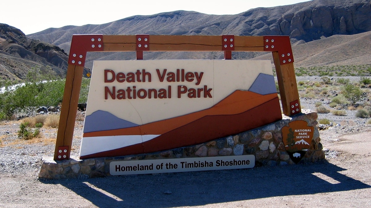
Prepare to Enter Death Valley
You are entering Death Valley. No matter the time of year it is, You Need To Come Prepared. Death Valley is unnaturally beautiful but its weather can be deadly if you are not prepared. You will have spotty if any cell phone coverage, At least have an extra supply of water, food, snacks, and clothing. Keep your fuel tanks filled. There are 2 fuel places in Death Valley, but don’t chance it. Top off Your Tanks in Pahrump.
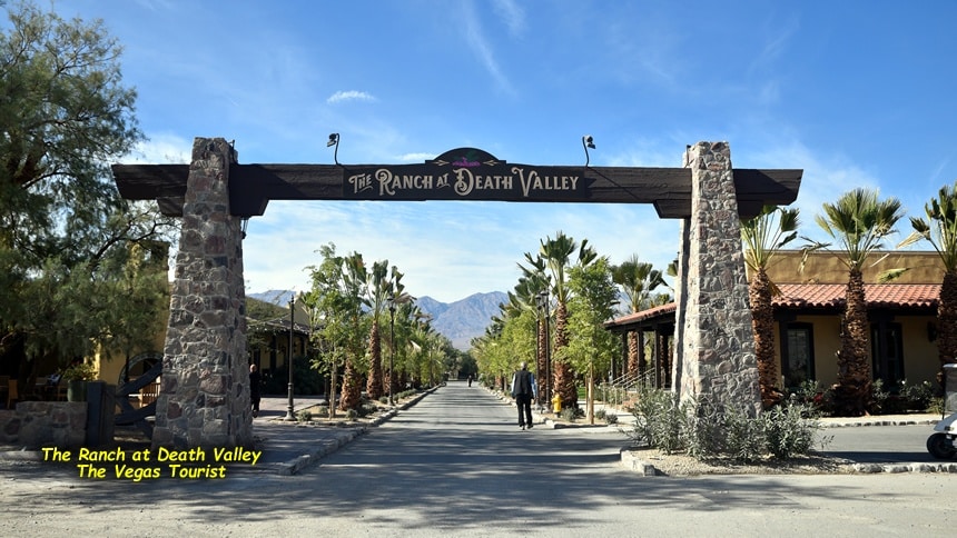
Once we got into Death Valley, We made a stop in Furnace Creek to see the changes at Furnace Creek Ranch. It’s now called “The Ranch at Death Valley” and is a whole new place that needs to be explored later. From there, we headed up thru Stove Pipe Wells and the Sand Dunes then up towards Panamint Springs.
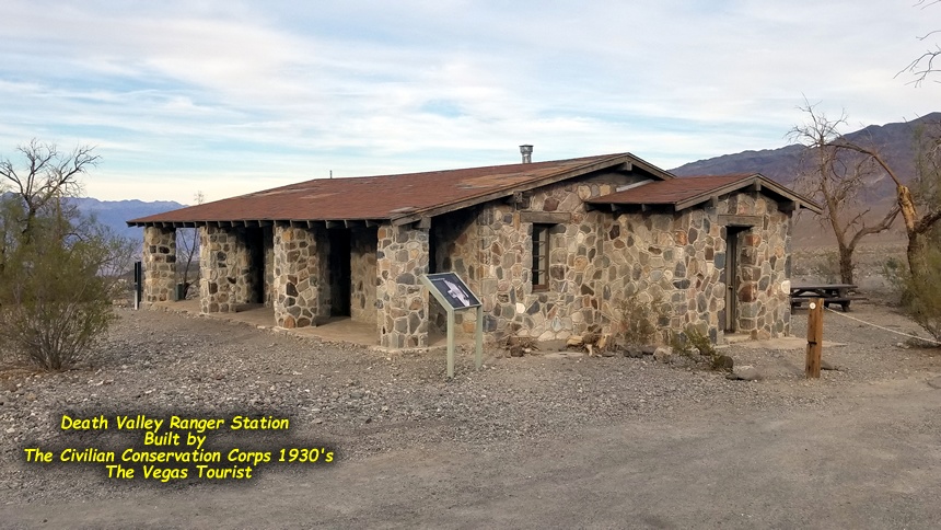
We stopped at the old Death Valley Ranger Station. A structure that was built by the Civilian Conservation Corps in the 1930’s. There are restrooms there. So take advantage of them if you need to! On one of the markers there, they note that cowboy poet Stan Jones was a Death Valley Park Ranger between 1946 and 1948 and lived across the street from here when he wrote the song “Ghost Riders in the Sky”.
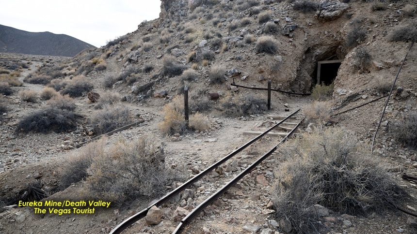
From there, we turned left. Followed the paved road a few miles before we saw the turnoff to Eureka Mine. You are now leaving the modern world of smooth road travel. Just letting you know… It’s a 6-mile dirt road that is rough. Seriously, I mean it’s ROUGH!! If you go too slow, your car will be shaken to pieces. If you go too fast, you could lose control and crash. Find that sweet spot and stick with it…
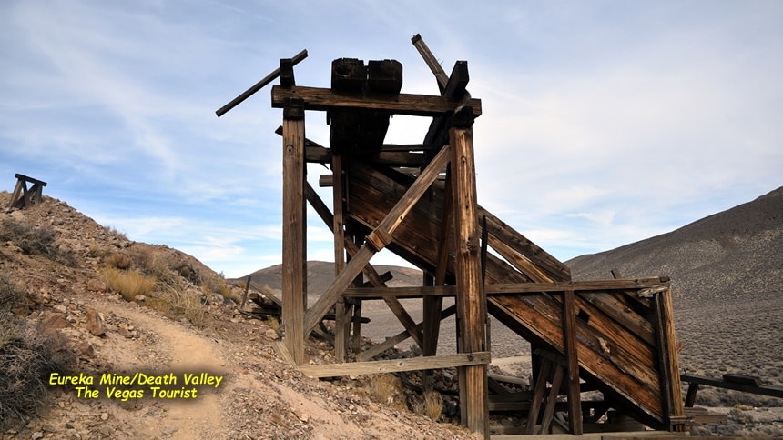
On the way, we passed Peter Aguereberry’s homestead and mining mill operation. Pete was a French-born immigrant who spent 45 years mining and milling in this area. He is the man they named the point after. We Continue further up the narrow, rough and climbing mountain road.
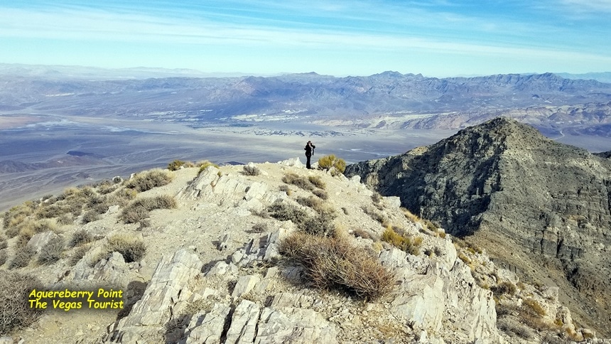
As the road levels out, we were amazed at the view before us. It is jaw-dropping. Stop and take a breather. It’s certainly worth the time to just stop and take it all in. Look at the valley below you, see the strata lines in the rocks. But this is not the point. You still have a little more hill to climb for THE actual Aguereberry overlook.
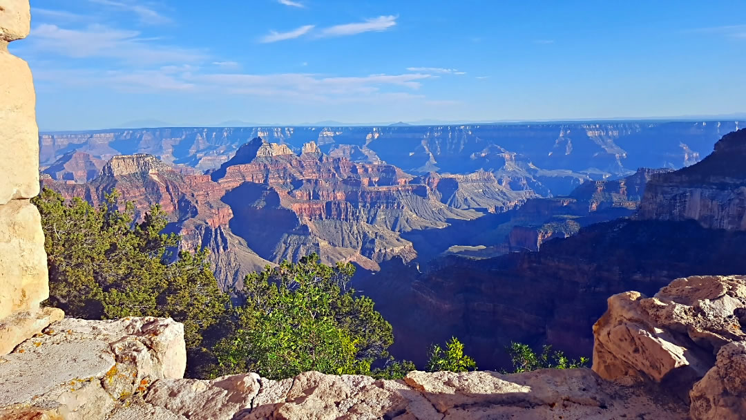
Witnessing the Beauty of Aguereberry Point
Once we get acclimated to that sight, we continue driving up to the actual point. Yup, they were right. Aguereberry Point makes Dante’s View look like a rest stop
looking at the Panamint mountain range, we could see salt flats of Badwater Basin below us, and looking further back, the furthest mountain peaks are actually Mt Charleston. The mountains you see from your Las Vegas hotel room.
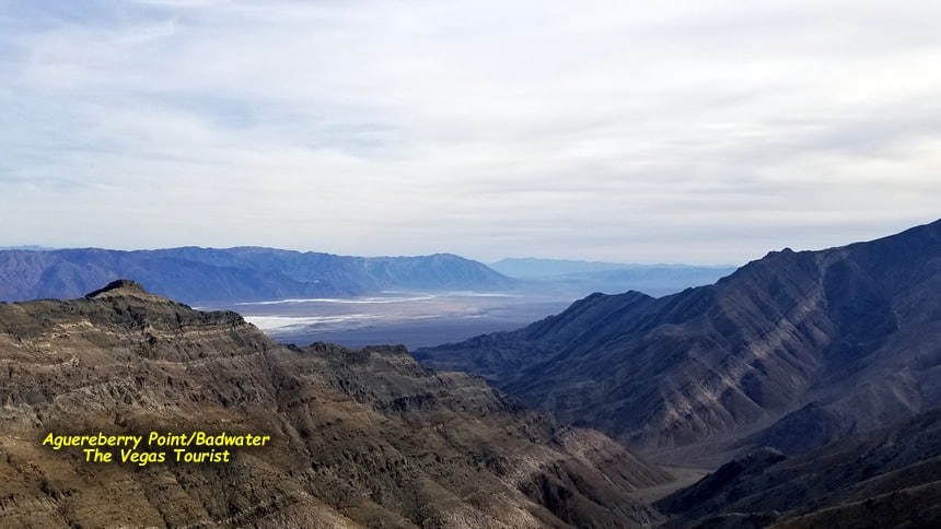
Walking a little to the north and around some rock, THAT’S the viewpoint you want to just sit and take it all in from! Looking out in the distance – the greenery in the distance was Furnace Creek and the Inn at Death Valley. Places we passed coming into Death Valley.
Scanning the scenery around us, you can see the details of the fault lines that run thru Death Valley. Also in the rock formations, you can see the various layers of strata. The earth’s timelines of when this was covered by ancient seas, lush prairies, layers of ice, mountain lakes and now desert sands. Millions of years in the creation. It’s all there in those rocks.
Then to realize that we are at 6,433 feet above the valley floor. Remembering that Badwater is 283 feet below sea level and sinking. So the elevation is from the bottom of the floor upward, not sea level!
If it wasn’t the end of November and cold, we would have stayed and had our lunch there. But we took it all in, not really wanting to leave – we headed back down.
Eureka Mines and More!
Stopping at the Eureka Mine area and explored some of that. Death Valley is littered with 1000’s of old abandoned mines, ghost towns, and miners camps. Places like this are always worth the stop to look around, explore and ponder what made people come out here in the first place? Pete Aguereberry came out here in 1905 and died on Nov. 23, 1945, at Tecopa Hot Springs at age 72.
Once we got back onto the highway, we headed towards Beatty. when traveling this stretch of open highway, you always need to make a detour to visit the ghost town of Rhyolite. This trip, with the sun setting, we decided to skip the actual town and visit the cemetery. Then onto Beatty and the Death Valley Nut and Candy company (and Chevron gas station). Where we always find vintage candy and snacks you just can’t find anywhere else. Stuff from our childhood! Topping off our fuel tank and heading back home to Las Vegas from the north.
On this leg, you pass Mercury, home to the Las Vegas Test Site as well as Creech Airforce base is nearby. Creech is home to one of the largest battalions of Drone pilots we have in America.
All in all, a very reward, fun and adventurous day in Death Valley!
Be the first to comment